Historical New Orleans
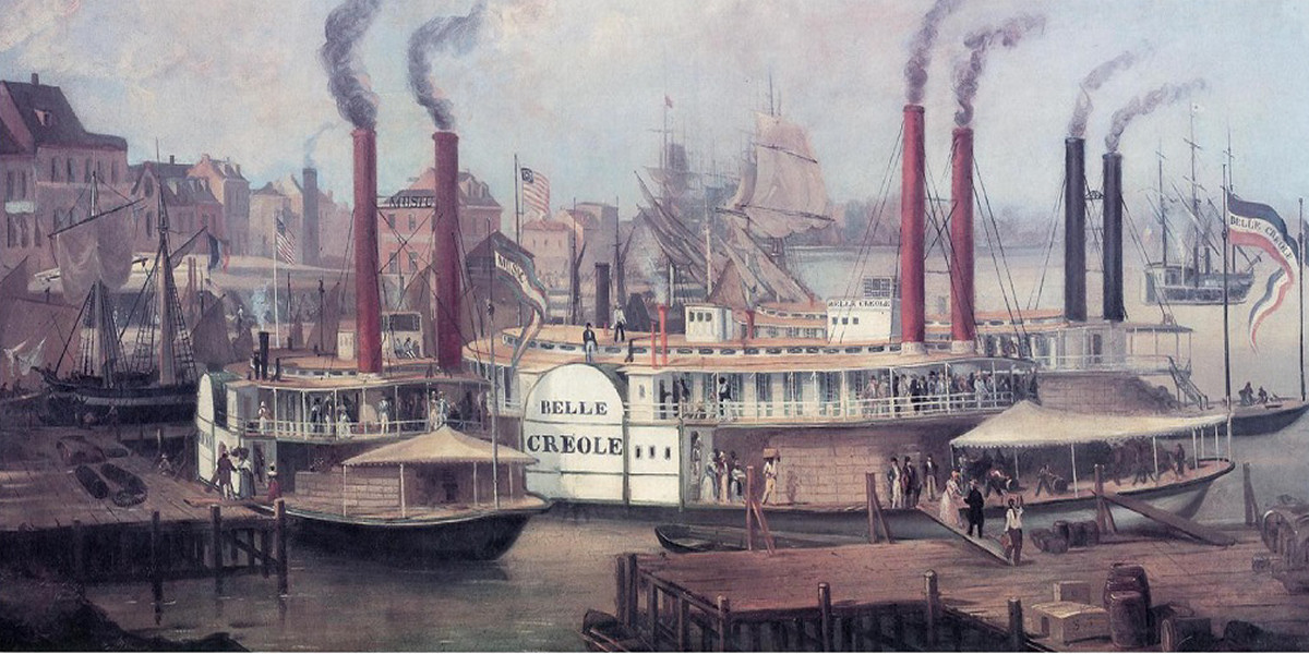
I collect old illustrations, paintings, and other ephemera pertaining to New Orleans, Liverpool, and ships of old as such things make me feel closer to my story, to my characters. One of my favorites is the 1845 painting above of New Orleans and the Belle Creole. The painting gives one a sense of the busy riverside back in those long ago days and the majestic beauty of the early steamships that plied the Mississippi.
Here’s a description of New Orleans in 1845 from Benjamin Moore Norman’s, Norman’s New Orleans and Environs
“During the business season, which continues from the first of November to July, the levee, for an extent of five miles, is crowded with vessels of all sizes, but more especially ships, from every part of the world — with hundreds of immense floating castles and palaces, called steamboats; and barges and flat-boats innumerable. No place can present a more busy, bustling scene. The loading and unloading of vessels and steamboats — the transportation, by some three thousand drays, of cotton, sugar, tobacco, and the various and extensive produce of the great west, strikes the stranger with wonder and admiration. The levee and piers that range along the whole length of the city, extending back on an average of some two hundred feet, are continually covered with moving merchandise. This was once a pleasant promenade, where the citizen enjoyed his delightful morning and evening walk; but now there is scarcely room, amid hogsheads, bales and boxes, for the business man to crowd along, without a sharp look out for his personal safety.”
This map of New Orleans in 1770 by Pittman gives one another peek into historical New Orleans. The city grew so fast and, though always a busy port city, traffic on the Mississippi had picked up significantly with the advent of the steamship. Old maps can certainly inspire one’s imagination, take one to another place in time. Click the image if you wish to see the full-size version.
